Empowering Chicago’s commute: Better Streets for Buses paves the way to equitable and innovative transit
- Like
- Digg
- Del
- Tumblr
- VKontakte
- Buffer
- Love This
- Odnoklassniki
- Meneame
- Blogger
- Amazon
- Yahoo Mail
- Gmail
- AOL
- Newsvine
- HackerNews
- Evernote
- MySpace
- Mail.ru
- Viadeo
- Line
- Comments
- Yummly
- SMS
- Viber
- Telegram
- Subscribe
- Skype
- Facebook Messenger
- Kakao
- LiveJournal
- Yammer
- Edgar
- Fintel
- Mix
- Instapaper
- Copy Link
Posted: 18 January 2024 | Jennifer Henry - Chicago Transit Authority | No comments yet
Jennifer Henry, Director of Strategic Planning and Policy at the Chicago Transit Authority (CTA), sat down with Intelligent Transport’s Halimah Haque to discuss the transformative Better Streets for Buses plan, highlighting its collaborative approach, community-centric design and the integration of emerging technologies to shape the future of accessible and efficient public transportation in Chicago.
Can you please tell us about the Better Streets for Buses plan and how it addresses the specific accessibility needs of different communities within Chicago, ensuring equitable access to public transportation?
Better Streets for Buses is one of our initiatives aiming to improve both equity and overall access. The real goal of Better Streets for Buses was to have a joint plan with our Chicago Department of Transportation (CDOT), which has jurisdiction over the streets. So, for things like bus lanes or signal changes, we really need to be working with CDOT. We’re really excited to have a framework for the whole city that both agencies have worked together to develop.
Having a plan to improve and bring bus to the forefront is one step towards increasing equity for parts of the city that haven’t received as much attention for a long time”
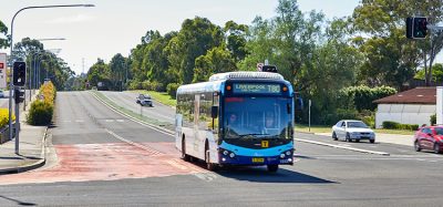
Better Streets for Buses by itself doesn’t guarantee equitable access, but it’s certainly a tool to improve it. One thing to know about Chicago is that although we’re known, especially within the U.S., for our rail system, our bus system has been the real transit workhorse of the city. For most of the Chicago Transit Authority’s (CTA) history, we’ve seen more bus rides than rail rides. And Chicago is a big city; if you look geographically at the city, you’ll see that the rail system reaches a significant portion of the city. However, there are huge swaths of the city that don’t have rail access and, for them, bus is public transport. So, having a plan to improve and bring bus to the forefront is one step towards increasing equity for parts of the city that haven’t received as much attention for a long time.
In terms of how we picked the corridors in the network, we definitely thought about equity. In the extensive plan document, there’s actually a map of the MOBEC Index, which is something that CDOT developed. The MO is for mobility, and the EC is for economic hardship. The index is based on a variety of factors, mobility indicators and economic hardship indicators showing which parts of the city currently have the least mobility and the most economic hardship, and maps them together. We looked at the MOBEC Index as we were designing and picking the corridors, as well as focusing on improving connectivity of course.
You’ve briefly touched upon this, but how does the plan contribute to fostering community connections and inclusivity through its implementation with a focus on enhancing connectivity for all residents?
The development of the plan itself was informed by a city-wide outreach process, and we aimed to be as inclusive as possible, given our resources and our reach. We have also worked with a group here in Chicago called the Transportation Equity Network, it’s a group of advocacy organisations led by several groups that have tended to focus on citywide urban planning and transportation issues. They’ve tried to reach out and bring in some of the more local community-based organisations that wouldn’t necessarily typically be involved in these conversations.
These community-based organisations are dealing with a lot of issues every day. They’re small, and so to expect them to stay on top of every high-level planning effort that the city is undertaking is a lot. So, the Transportation Equity Network serves as a guide and a convener for them. We had worked with them during the development of the plan, and we’re continuing to work with them as we figure out our implementation next steps.
In consideration of street scape design, can you please provide examples of how the plan addresses various elements to ensure a more comfortable and efficient transit experience for passengers?
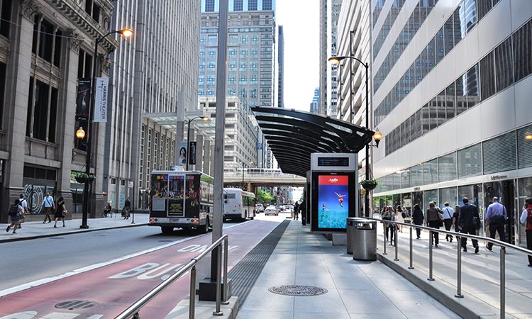
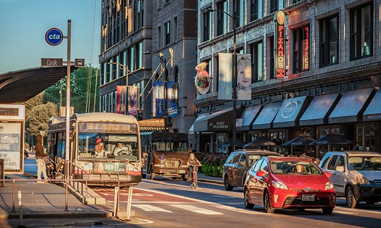
There’s a ‘toolbox’ of 19 tools in the plan, organised into three categories. For example, the bus-friendly street category includes things like bus lanes or bump outs so that the bus doesn’t have to pull out of traffic, or for streets where there’s a bike lane or a lot of bike activity, boarding islands. These are changes you make to the street primarily aimed at improving the speed and the reliability of the buses. Keeping the buses out of traffic, or at least reducing the number of in and out of traffic manoeuvres, or reducing possible conflicts with cyclists, for instance. Safety is always paramount, and our bus drivers are trained to be cautious, so measures such as these enable them to move more smoothly, helps organise the streets and gives the bus priority.
Safety is always paramount, and our bus drivers are trained to be cautious, so measures such as these enable them to move more smoothly, helps organise the streets and gives the bus priority“
The bus-friendly intersections category is mostly where you find the tools that are about traffic signals. For instance, traffic signal priority that gives early or extended green lights, particularly to buses that are running behind schedule. In a couple of places already in Chicago are queue jumps, which is a vertical white line signal just for the bus. It usually goes with the leading pedestrian signal. So, buses can go and people can walk and the cars are held back with a red light, giving the buses just a little bit of a head start. Again, this is mostly aimed at speed and moreover, reliability. These sorts of tweaks, especially for transit signal priority that’s aimed at a bus running late, improve the overall reliability which is really important to the customer experience.
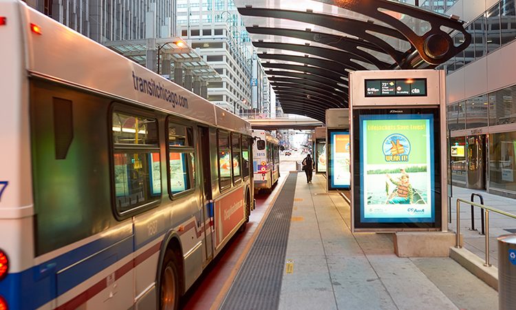
Finally, we have the bus stop improvements category. That’s where you find things such as improvements to bus shelters, but also improvements to the nearby accessible paths, or ensuring that there is a safe crossing for those reaching and leaving the bus stop. Also, real-time arrival signs, which relay crucial information to passengers, are also in that category.
Public engagement must have played a crucial role in the development of this plan. So, how were the diverse transportation needs and preferences of residents in Chicago taken into account during the planning process, and how will these preferences shape the ongoing implementation?
The goal of the public outreach was to get as many opinions from across the city as possible about which bus routes were most important to Chicago’s residents”
The goal of the public outreach was to get as many opinions from across the city as possible about which bus routes were most important to Chicago’s residents, and where they thought bus priority tools might be most needed. We worked hard to reach every community as evenly as possible. The pandemic naturally had an impact on this, but we were mindful about interpreting results in the context of somewhat differing levels of participation between communities.
We also looked other key data sets as well. We studied ridership, analysing where we have the most service frequency, where we see buses having slow speed issues and then gauging for geometric feasibility meaning where might we be able to put in a bus lane and geographic connectivity. We wanted a network that would cover the whole city. As I mentioned earlier, we considered equity in a variety of ways. We looked at it both through traditional metrics of equity that we use to make sure we are meeting federal requirements, but also by looking at CDOT’s MOBEC index and its map.
With a comprehensive ‘toolbox’ of 19 potential street treatment options, how does the BSB Plan provide flexibility to tailor improvements based on the unique needs of each corridor? Can you provide examples of how this flexibility will be applied in different neighbourhoods across the city?
The Better Streets for Buses plan is the start. It is a framework plan, and there are trade-offs to be made with these tools, and there’s a lot of context sensitivity that you need to have”
The Better Streets for Buses plan is the start. It is a framework plan, and there are trade-offs to be made with these tools, and there’s a lot of context sensitivity that you need to have. Not everyone is excited about converting their parking to a bus or travel lane. It would be too much to take on assigning specific treatments to every corridor in the whole city all at once. So, the strategy is, “Here are the corridors we want to focus on, now we’ll do more design and planning work and more work to involve the communities directly in developing those designs.” That’s why it’s laid out as ‘here are the corridors and here is the toolbox’. It’s set up to be very flexible for that reason.
For example, in a very congested part of the city where there might be a lot of support for a bus lane because it’s critical to making the bus faster, we would be looking for the best design for bus lanes that would balance community needs – what space do we repurpose, how can we best mitigate any trade-offs that have to be made for that space. In another part of the city that has less traffic, you might still want a bus lane because it gives a visual priority to the bus, but it might not make as much of a difference in speed. As such, so that would be a decision that the community weighs in on. There are pros and cons, but what that community might really want is more accessible paths to bus stops. There might be broken pavements or other issues that are the priority to address from community members and bus riders in that area. It’s about tailoring solutions to the needs of individual neighbourhoods.
Some of the areas where there are bus stops in Chicago, don’t have a concrete pad at the bus stop. Instead, there’s parkway with grass. We are working with CDOT to improve this, as grass makes it difficult to deploy a ramp for a wheelchair. So, the focus might be on improving the stop environment in one part of the city if traffic congestion there doesn’t warrant the treatments that are geared towards speed and reliability.
As the Better Streets for Buses plan is implemented, what measures are in place to regularly assess its effectiveness, and how will the findings be used to adapt and improve the plan in the future?
It’s a great question. We have evaluated the success of various bus priority projects in the past in various ways, but we do not have a comprehensive formal process in place yet. Previously, we have conducted before and after analyses on different projects gauging effect on speed and reliability, and ridership. We also typically do customer surveys, to gain feedback on people’s opinions and response to the work. So, I would anticipate at a minimum, continuing to do that as projects go in. There are a number of stakeholders and advocacy groups that want this information, for general information and to help hold us accountable too.
Some treatments can work really well in one context and not in the other. One lesson we’ve learned from the projects that we’ve done is that compliance from general traffic in staying out of the bus lanes or bus zones can be an issue that impacts the performance and benefits of the project. We currently don’t have any sort of camera or automated enforcement of bus lanes, like some other cities do. This is something that we’re also working on.
Looking ahead, how does CTA envision the integration of emerging technologies and innovative transit solutions to further enhance the accessibility, efficiency, and sustainability of public transportation in Chicago beyond the current scope of the Better Streets for Buses plan?
We are always looking at technology. The electrification of our bus fleet is another big initiative. About a year and a half ago, we released a strategic plan to electrify our entire bus fleet by 2040. The goal of that plan essentially is to figure out how best to get to 100% electric. But along the way, as the technology evolves and as we learn, we may also look at other technologies for low emission vehicles.
We’re looking at ways to enhance our real-time arrival information. This is increasingly important for a variety of reasons. Real-time information has been important since its roll-out, but increasingly, it informs people’s decision making and when it’s off, it can really affect the experience of riding the bus. As such, we are both enhancing the accuracy of the information and also finding ways to make it more available. On the one hand, anybody with a smartphone does have access, but they don’t always know that they have access or how to use it. And not everyone has a smartphone. There’s a number of new technologies to more easily incorporate real-time information into the bus stop without having to have the full shelter and sign that we’ve done at stops in the past. We are also working on incorporating new technology into disruption management. Effectively, when things go wrong, how do you adjust?
 Jennifer Henry currently directs Chicago Transit Authority’s Strategic Planning & Policy group, which advances planning for major capital projects for rail and bus and leads co-ordination with City of Chicago and regional agencies on many policy fronts, including land-use planning, roadway design for transit and funding. Current or recent projects led by the Strategic Planning & Policy group include the “Charging Forward” report that is a roadmap for CTA’s full bus fleet electrification by 2040, the “Better Streets for Buses” plan, developed jointly with the Chicago Department of Transportation and the advancement of CTA’s Red Line Extension and Red Purple Modernization projects.
Related topics
Accessibility, Passenger Experience, Public Transport, Sustainable Urban Transport
Related modes
Bus & Coach, Rail
Related cities
Chicago
Related countries
United States
Related organisations
Chicago Department of Transportation (CDOT), Chicago Transit Authority (CTA)
Related people
Jennifer Henry