Navigating the Outback: Real-time bus tracking in regional New South Wales
- Like
- Digg
- Del
- Tumblr
- VKontakte
- Buffer
- Love This
- Odnoklassniki
- Meneame
- Blogger
- Amazon
- Yahoo Mail
- Gmail
- AOL
- Newsvine
- HackerNews
- Evernote
- MySpace
- Mail.ru
- Viadeo
- Line
- Comments
- Yummly
- SMS
- Viber
- Telegram
- Subscribe
- Skype
- Facebook Messenger
- Kakao
- LiveJournal
- Yammer
- Edgar
- Fintel
- Mix
- Instapaper
- Copy Link
Posted: 23 November 2023 | Transport for New South Wales (TfNSW) | No comments yet
For Intelligent Transport, Transport for New South Wales provides a detailed insight into the agency’s Transport Connected Bus programme, discussing the significant role it has had in shaping the future of public transport in the region by integrating cutting-edge telematics technology, offering real-time tracking, automated passenger counting and improved accessibility across diverse landscapes.
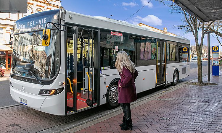

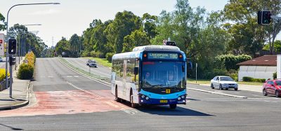
Credit: Transport for New South Wales
While users of public transport in major cities around the world are generally familiar with convenient, real-time journey tracking of their daily bus commute, regional Australia tells a different story.
Australia is one of the most sparsely populated countries in the world and, while most of the land mass is considered regional, the bulk of the population lives in metropolitan areas, close to the coastline. New South Wales (NSW) is an Australian state of more than 800,000km2; bigger than Spain and the UK combined.
Australia is one of the most sparsely populated countries in the world and, while most of the land mass is considered regional, the bulk of the population lives in metropolitan areas, close to the coastline”
The state’s public transport department, Transport for NSW, recognises the unique public transport challenges and opportunities that regional areas face, including isolation, lower population density and, sometimes, poor digital connectivity. This is particularly acute in the remote areas located far inland from the east coast of NSW, where population centres can be hundreds of kilometres apart.
Transport for NSW’s Executive Director of Intelligent Transport Systems, John Paul Ahern, has said that the department has been working on innovative solutions that are suitable for the regional transport landscape.
“We are delivering services and technology to fit the unique public transport network in regional NSW that meet customer needs, noting that travel patterns differ from those in metropolitan areas,” Ahern said. “One exciting initiative is an ambitious programme of installing state-of-the-art passenger counting and vehicle tracking technology across the entire fleet of public transport contracted buses, including in rural and regional NSW.”
Once a bus is fitted with the technology, passengers can use a variety of apps, including Transport for NSW’s own Trip Planner, to track that vehicle, accessing real-time trip information on where their bus is, its expected arrival time and how full it is. Several third-party apps can also use and distribute this information.
“While buses in metropolitan areas of NSW, like Sydney, have had this facility for some years, replicating that in the regions through our Transport Connected Bus (TCB) programme is a significant and complex undertaking,” Ahern continued. “This programme is making public transport in regional NSW more accessible and convenient, by allowing people to get on-board buses more easily and with less stress.
“Having up-to-date journey information at their fingertips helps passengers to better plan their trips and provides visibility to parents and carers waiting at a bus stop for their child, elderly relative or any loved ones.”
A phased roll-out of the TCB programme is underway, with more than 1,400 buses already fitted with the technology. Furthermore, the recently announced roll-out of Phase 3 means that another 1,800 buses will be installed with this technology.
Scaling up the Transport Connected Bus programme in NSW
By the scheduled conclusion of the TCB programme at the end of 2025, more than 3,000 buses in regional NSW will have smart technology, providing services on more than 3,800 routes. Since July 2020, under the programme, more than 1.8 million trips have been tracked.
The Transport Connected Bus system also provides more accurate data and tools to bus drivers and operators to help to keep services running on time”
The Transport Connected Bus system also provides more accurate data and tools to bus drivers and operators to help to keep services running on time and can help Transport for NSW with planning for future improvements to services.
One of the complexities of the programme is that Transport for NSW needs to work with more than 490 bus operators to ensure a consistent application of the technology in a multitude of different settings.
Public bus services in regional NSW, both regular route passenger services and school services, are provided by private bus operators under contract to Transport for NSW.
Ahern has highlighted that public transport bus services are not ‘one-size fits all’ in regional NSW, stating: “Operators range from large fleet companies to so-called ‘mum and dad’ contractors operating a single minibus, transporting children from farms to and from school each day.
“Transport for NSW’s delivery team has worked tirelessly over the past few years of this roll-out to plan, create and implement a range of operator engagements, including more than 30 information and training sessions.
“Now, with Phase 3 underway, they are partnering with 420 additional operators across eight distinct regions of NSW. There is still a lot of work ahead, but we are looking forward to continuing to make a real difference to the travel experience of regional communities.”
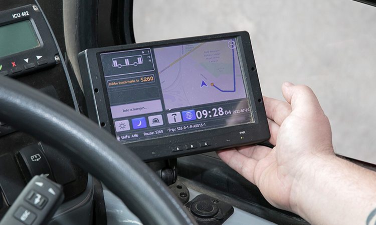

Credit: Transport for New South Wales – Drivers interact with the system via a seven-inch touchscreen, and all of their interactions are performed whilst the bus is stationary.
Transport Connected Bus technology
The vehicle tracking and passenger counting technology is provided by a Consat telematics system and has four components.
The following equipment is required as part of the solution:
- Driver console
- On-board computer (OBC)
- Automatic passenger counting device (APC)
- Antenna quad-band (cellular 4G, GPS, Wi-Fi).
The drivers interact with the system via a seven-inch touchscreen, and all of their interactions are performed whilst the bus is stationary, and at the start or end of a journey.
The on-board computer is the system’s main computer, which automatically collects and relays service information such as location, time, direction, number of passengers on-board and ignition status to the back-end system.
Ultimately, this technology provides bus operators with tools to connect with customers, manage operations and keep services running on time”
The OBC has a 4G SIM and is GPS-enabled, tracking the location and speed of a vehicle on every trip. The digital driver display helps drivers to select the trips and view the route path on a map for their trips, while the passenger counter uses infra-red and motion sensors to detect the boarding and alighting of passengers on the vehicle.
Real-time vehicle tracking information is also available when there is cellular network coverage available. However, where there is no network coverage available, the data is stored locally on the vehicle computer. This data is then sent through when the vehicle comes back into an area with network coverage, ensuring that no data is lost.
Therefore, when a vehicle is in a ‘black spot’, customers will not have access to real-time information for this service via website and apps. They will see a message that states, ‘Real-time information not available’.
The automatic passenger counting device has a sensor that emits an infra-red beam that automatically counts passengers as they board and alight the bus. The devices are installed above each passenger door, so passenger counting is automatically triggered when the door opens and passengers pass through them.
Once the vehicle leaves a designated stop zone, the driver console updates to show the total number of passengers on-board, as well as the individual numbers of passengers that had boarded and alighted at the previous stop.
All of this information is captured and transmitted in real-time to Transport for NSW and third-party trip planning apps, along with the predicted arrival time of the vehicle for all of the next stops of the trips. This helps the public to plan their trip in advance and see the occupancy of a vehicle.
Ultimately, this technology provides bus operators with tools to connect with customers, manage operations and keep services running on time.
Transport for New South Wales (TfNSW) is the government agency overseeing the co-ordination and improvement of the transportation system in the state, with a focus on innovation and technology to enhance accessibility and efficiency for both urban and regional travel.
Related topics
Accessibility, Intelligent Transport Systems (ITS), Journey Planning, Passenger Experience, Public Transport, Travel & Passenger Information
Related modes
Bus & Coach
Related cities
New South Wales, Sydney
Related countries
Australia
Related organisations
Transport for New South Wales (TfNSW)
Related people
John Paul Ahern
