Enhancements to cycling navigation in Google Maps to benefit Londoners
- Like
- Digg
- Del
- Tumblr
- VKontakte
- Buffer
- Love This
- Odnoklassniki
- Meneame
- Blogger
- Amazon
- Yahoo Mail
- Gmail
- AOL
- Newsvine
- HackerNews
- Evernote
- MySpace
- Mail.ru
- Viadeo
- Line
- Comments
- Yummly
- SMS
- Viber
- Telegram
- Subscribe
- Skype
- Facebook Messenger
- Kakao
- LiveJournal
- Yammer
- Edgar
- Fintel
- Mix
- Instapaper
- Copy Link
Posted: 17 October 2023 | Intelligent Transport | No comments yet
In a ground-breaking collaboration, Google Maps and TfL have updated their algorithms to prioritise safer cycling routes, making cycling in London even more accessible and secure.
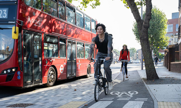
Credit: Transport for London
Millions of Londoners are set to enjoy safer and more convenient cycling experiences as a result of a partnership between Google and Transport for London (TfL). Informed by TfL’s valuable insights, Google has made significant updates to its algorithms within Google Maps, prioritising cycling on safer and quieter roads while making them more accessible to users.
The latest update is expected to make cycling in the capital city even safer and more comfortable for everyone who relies on the app for navigation. In July 2022, TfL hosted an innovation summit to identify and address key challenges faced by cyclists in the city. One of the primary issues highlighted was the lack of up-to-date data in travel planning tools. Despite TfL and the boroughs having delivered over 340km of cycle routes in London, existing digital journey planners often failed to consider these, resulting in suboptimal cycling routes.
Since the summit, Google has joined forces with TfL’s Open Innovation team and experts to address these issues and enhance cycle routing in Google Maps. This innovative collaboration approach enables TfL to provide valuable pre-launch feedback on product enhancements, ensuring continued refinement as the product develops further.
In addition to safer cycling route choices, Google Maps is introducing new features to improve the cycling experience in the capital. Users will now have access to a detailed breakdown of their chosen route, showing road types, such as major roads or segregated cycle lanes, at a glance.
“Immersive View” for cycle routes in Google Maps has also been introduced, allowing users to preview their routes in advance, including all the cycle lanes and junctions along the journey. This feature will gradually roll-out in London and other select cities around the world, with TfL collaborating closely to refine the cycling routing experience during this expansion. Users are encouraged to provide feedback through the “Send Feedback” option in Google Maps if they discover better alternatives to the suggested routes.
London’s Walking and Cycling Commissioner, Will Norman, said: “I’m delighted that Google Maps is enhancing the navigation system for cycling. With existing digital journey planning data, cyclists haven’t always been able to see the best route available to them. These updated algorithms will help Londoners choose safer cycling routes, whether it is a road with less traffic or part of the Mayor’s growing network of Cycleways, enabling more people to get around by bike as we build a greener and better London for everyone.”
Hannah Fallows, Open Innovation Partnerships Manager at TfL, said: “Our collaboration with Google is a fantastic way of using our shared expertise to make active journeys easier for everyone. The improvements to digital wayfinding through navigation apps like Google Maps give cyclists confidence about the journey they are about to undertake, especially if it’s not a regular route.”
Ajay Arora, UK Partnerships Lead at Google Maps, said: “To help make cycling easier for more people, we’ve been working with local governments to ensure Google Maps shows up-to-date cycling routes. We are delighted to collaborate with organisations like Transport for London to add hundreds of kilometres of new cycle lane data.”
Related topics
Accessibility, Active travel, Vehicle & Passenger Safety
Related modes
Bikes & Scooters
Related cities
London
Related countries
United Kingdom
Related organisations
Google Maps, Transport for London (TfL)
Related people
Ajay Arora, Hannah Fallows, Will Norman