Bird launches augmented reality-powered parking technology pilot
- Like
- Digg
- Del
- Tumblr
- VKontakte
- Buffer
- Love This
- Odnoklassniki
- Meneame
- Blogger
- Amazon
- Yahoo Mail
- Gmail
- AOL
- Newsvine
- HackerNews
- Evernote
- MySpace
- Mail.ru
- Viadeo
- Line
- Comments
- Yummly
- SMS
- Viber
- Telegram
- Subscribe
- Skype
- Facebook Messenger
- Kakao
- LiveJournal
- Yammer
- Edgar
- Fintel
- Mix
- Instapaper
- Copy Link
Posted: 13 May 2022 | Intelligent Transport | No comments yet
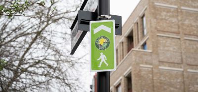
With the use of augmented reality technology and street view data, Bird VPS will enable Bird to geo-localise parked e-scooters with accuracy – allowing riders to end their journeys in a safe and tidy manner.
Credit: Bird
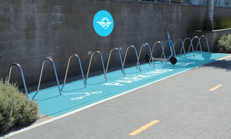
Micro-mobility operator Bird has announced the launch of its new parking technology, Bird Visual Parking System (VPS), which is available for free to city partners and requires zero infrastructure or technology investments on behalf of the community.
Bird VPS is a scalable, revolutionary new parking tool, powered by Google’s ARCore Geospatial API. The technology enables Bird to geo-localise parked e-scooters with pinpoint accuracy by leveraging years of Google 3D scanning, augmented reality (AR) technology and Google Maps Street View data from around the world. With this new technology, Bird riders can more accurately and precisely end their eco-friendly rides in a tidy manner while adhering to parking guidelines, in an effort to keep walkways and ramps free of obstruction.
“The new ARCore Geospatial API from Google is an absolute game changer for micro-mobility that allows us to offer cities a first-of-its-kind Visual Parking System that’s unmatched in terms of accuracy and scalability,” said Justin Balthrop, Chief Technology Officer at Bird. “With Bird VPS, we’re able to meet cities’ number one need – proper parking – in a way that’s never been possible before, and we’re able to do it at scale in cities around the world thanks to Google’s robust global data and technology.”
Voi Technology to deploy AI computer vision on e-scooters in Oslo, Norway
The technology exists within the micro-mobility operator’s app and can be used on both iOS and Android operating systems, allowing for it to scale to all Bird riders over time and to be immune to theft or vandalism.
When using Bird VPS, riders are prompted to quickly scan the surrounding area with the camera on their smartphone once they are ready to end their ride. With the use of the new technology, Bird instantaneously compares the rider’s images to those in Google’s knowledge base of data and street view images. With the resulting centimetre-level geo-location, Bird VPS will either allow the rider to park and go on with their day (if it complies with local city parking requirements) or prompt them to correct the vehicle’s parking before ending the ride.
The new system is currently being piloted in New York City, San Francisco and San Diego in the U.S., with plans to expand to more of Bird’s 400 plus partner cities.
If you liked this, you may also be interested in:
▶ Smart scooters: How technology enhances shared micro-mobility
Related topics
Intelligent Transport Systems (ITS), Mobility Services, On-Demand Transport, Passenger Experience
Related modes
Bikes & Scooters
Related cities
New York, San Diego, San Francisco
Related countries
United States
Related people
Justin Balthrop